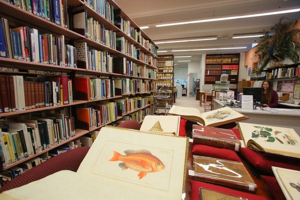
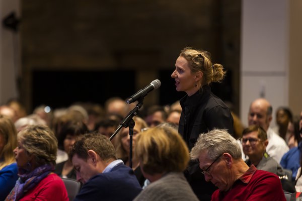
AMRI Seminars and Lectures
Leading Australian Museum scientists, affiliates and associates present their latest research and findings.
The Australian Museum has a long history of presenting lectures and seminars on a variety of scientific and cultural topics. That tradition continues with the Australian Museum Research Institute Seminar Series, a platform for AMRI scientists, associates and collaborators to present recent research and findings to their peers.
Since 2020, many of these presentations have been delivered online due to the constraints of the COVID-19 pandemic. Below you can find some of these recordings.
Platypuses at Jenolan: insights, new information and challenges
Presented by Anne M. Musser1,2, Tom Grant3 and Eren Turak4
1Jenolan Caves Reserve Trust; 2Research Associate, Australian Museum; 3University of New South Wales; 4NSW National Parks and Wildlife Service.
Recorded Wednesday 12 April 2023
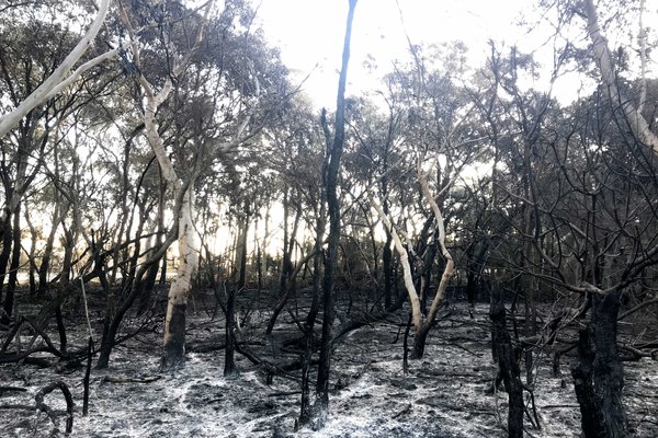
The 2019-2020 bushfire followed by two major flood events severely impacted Jenolan Karst Conservation Reserve. Hillside vegetation was destroyed, and gravel and rocks partially filled the Blue Lake after both floods, reducing Platypus foraging habitat. The team conducted a Platypus monitoring study before, during and after subsequent draining, excavation and refilling of the Blue Lake, with partial restoration of mixed benthic substrate to facilitate reoccupation by macroinvertebrate prey.
The team recorded strong site attachment to the Blue Lake and Jenolan River; movements through and over infrastructure such as culverts, pipes and drainage holes; movements around waterfalls and weirs; and some early recolonization of the modified Lake bottom by macroinvertebrate prey. Despite disturbances, there was at least one successful local breeding event in the 2020-2021 breeding season. Although a Platypus population will likely remain part of JKCR’s biodiversity, numbers are low and challenges are ongoing. Future extreme weather events could possibly modify the system beyond what would support a viable Platypus population into the future. Planned monitoring studies should allow more accurate predictions for the future of this population to be made.
I would like to begin by acknowledging the traditional custodians of Jenolan, the Burra Burra clan of the Gundungurra people and the Gundungurra and the Wiradjuri nations, and we pay our respects to the Elders past, present and emerging. So we're going to talk today about a platypus study that we've done at Jenolan. You'll see how it basically evolved as we go through the talk and insights, new information, there's things that we found out that are actually brand new and the challenges of course that platypuses would face in a changing environment.
So to start with, the Blue Lake is very familiar to anyone who's been to Jenolan. It's a bit of an icon and a big tourist attraction, but if we look at it as a habitat for platypuses, it's basically a very good place for a platypus to forage and to build burrows in banks because you have a low energy pool. It's within a higher energy stream environment, but it's a dam and it's created a pool that has become extremely popular with platypuses over many generations and historically has probably been a platypus habitat since the construction of this dam in 1908. We'll talk a bit more about that in a minute, but since 2019 there have been several natural events that have created huge problems for the Jenolan environment, particularly the Blue Lake. We did have a bush fire come through on New Year's Eve in 2019 and it was followed by two major floods, both of which caused the Blue Lake to become severely contracted. We lost a lot of the pool and a lot of the macroinvertebrate prey that platypuses feed on. These are your benthic invertebrates that are critical to the survival of the platypus and for any habitat to be useful to the platypus. These events required two major desedimentation projects. The picture on your right is actually the end result of a flood in 2021 in March that actually deposited all that material to the end of the dam, 8 metres on the near side, 10 metres on the far side deep. That was over a period of only four or five days, but it was a massive water event. Some of you will remember that and that's what happened to our habitat. That has all required desedimentation. Prior to that, there was an event less than that, but still a very large event. That's the one you can see on your left, lower left. These projects were necessary to get back our habitat and to get the lake back. In doing so, the government, our trust, wanted to have a platypus monitoring program.
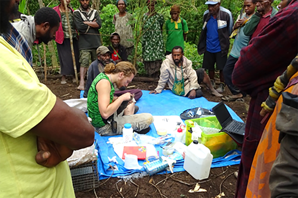
The program was in order to protect the habitat, to restore the habitat after the work was done, very critically important because of the benthic invertebrates that would be lost during the desedimentation works, and protect the platypuses from harm while the works were ongoing. And in the process, we would understand the movements of the platypuses through Jenolan, which have never really been studied. It was very important to the project to determine if and when the platypuses would return after the works were completed. Of course, this is a lot of disruption to the habitat and it's a very critical part of their habitat, so we needed to know their response after the works. We also know that desedimentation, as necessary as it is, will destroy the benthic invertebrate habitat, and advice on the restoration of benthic invertebrate habitat and the banks was part of the brief of our team. Our methods included visual monitoring. I actually spent, I think I came up with something like 3,000 hours staring into the water, having basically on-site monitoring while the works were ongoing and in between, so before, during, after the works, which was actually extremely useful, some very interesting insights. We had remote cameras, which we'll talk about in a bit. We did environmental DNA water sampling with EnviroDNA from Melbourne. Also, when the water was out of the lake and also another dam, I was able to do some mapping of where the refuges are beneath the banks, and possible burrows, you never really know, but that was also quite interesting and useful, especially if you can observe where they're coming and going from when the water is in the lake. Challenges, of course, that platypuses are cryptic, they're unpredictable. They are often, well, they are most active during the hours of darkness. We hardly had any knowledge prior to the works at Jenolan, as well-known as it is for platypuses, there just weren't any studies. And it's a very different environment to other areas that have been studied and I think Tom might talk a little bit about that. We're working in a greatly changed environment. After the fire and the floods, Jenolan has changed quite a bit. We are hoping that things stabilise and the ecosystems are all brought back into something of a balance and that we dealt with the impact of the sedimentation works, which as rough as they are to the environment, are actually really necessary, as I said, to bring the habitat back.
This is a little video I'm going to have up here; you can see that having platypuses in a work site is definitely something that can occur and another reason to have a monitor when there's machinery. What you're looking at next does not have machinery going on, so it's not a danger to the platypus, but have a look. It's a very young animal foraging, in very close proximity to a group of workers that were working on a scour valve replacement. They definitely can come in, especially if they get attracted by anything that gets stirred up.
Now, this is the study area. This map shows our system. Starting from the left, we have the Surveyor's Creek system. That's a small creek system. There's a weir there and we know that platypuses have used that. The weir goes back into the flowing creek, past the weir, of course. It enters a culvert. The culvert then meets up with the culvert from Camp Creek. They then join at the Grand Arch culvert, if you're following along. Then it joins the Jenolan River at the Blue Lake. The confluence of those waterways is where they all enter the Blue Lake. The Jenolan River is actually going underground before it gets to the Blue Lake. It's where the caves are forming in the northside cave system, although several kilometres upstream it actually is a flowing river. Then it descends into what's called the northern limestone. It can be seen in the Imperial Cave at Jenolan, which is a tourist cave. Then they all enter and form the Blue Lake. The Blue Lake, of course, the dam, again 1908. Past that, it's a free-flowing stream. We're going to visit this, the swimming hole and the falls. After that, again, a free-flowing stream, very steep and quite fast flowing. Another dam at the hydro plant, which is the hydro weir. Then it heads out to join the Cox's River. From there, it heads out to Warragamba Dam. We have looked at all of these sites, but we're talking today really about the Blue Lake and a bit about the swimming hole.
We measure our success for this by whether or not the platypuses are seen to be, basically, when they appear after the lake has been filled after the sedimentation, whether or not they can be seen feeding, after diving, which means at least some re-establishment of macroinvertebrate prey species. That's basically seeing an animal at the surface chewing. The chewing means that it's finding something to eat, of course, and that's a really great sign. That's one of the things I was watching for at the end of the two desedimentation events. That's one of the main aims of what we were looking for. When did they return? When were they feeding? When does that mean our benthic invertebrates were re-established and the platypuses were re-established? In the case of the first lot of desedimentation, which ended in November of 2020, we had active chewing and settling back into the lake within three months, although there was a platypus that was there less than 24 hours after the lake filled. They're very, very site-specific to the Blue Lake.
The diagram on your left is the same river diagram and lake diagram that we had before, but you can see where the remote cameras have been placed. So, C and D are the main cameras at the Blue Lake. The ones on the north side, we have a second one on the north side that was put in quite late and then one on the south side. There were also cameras at the Hydro Dam, which is number E, and at the culvert, which is D, which is a culvert that goes down through the system there. The platypuses use that whole system. I've seen and recorded platypuses going through the culverts, going under the Grand Arch, and even going into caves. So we're looking at those sites. We have eDNA sites. We won't talk much about that, but we got platypus DNA in 2021 from several places, including within one of the southside caves. And I have recorded platypuses swimming into the caves, so that's quite a neat sort of thing as well.
We have a picture of the lake here. You can see, again, a lovely pool and the banks on the far side. That's one of the best places for the burrows and for shelter. But you can also see the infrastructure. So, the platypuses were found to use infrastructure in a way that we didn't expect. And they also climb this rock slope that you can see on the right hand of this big photo, to get up into the lake. So starting with that, if you look at the photo at the top, right hand side, you can see a platypus is actually climbing that rock slope. So that platypus is coming from downstream. It's coming upstream. It climbed the rock slope. It has actually gone in through the hole through the dam that you can see the platypus is using in the picture beneath that. We call that the mouse hole. It's a drainage hole. And that was a big breakthrough finding out that they actually use that to transit. So that's one way they get into the lake. They may also go up and around, but that drainage hole has actually been a quite interesting thing to watch because a lot of the platypuses have used it to transit in and out. Now if you look at the siphons, there's a siphon that you can see closest to you. And that siphon goes up about 6 metres on the dam side. And it goes up and over, down, again, you're going all the way from above the dam to almost to the bottom, which is a 10-metre drop. And during the scour valve replacement, there was a remarkable discovery by the workers. They were down at the bottom where you can see the water rushing out. And they saw a young platypus come barrelling out in the cannonball position out through the siphon. And it surprised them. They thought, we'll never see that again in our lifetimes. An hour later, the same platypus, probably a young one, nice, comfortable fit in the siphon tube, came out again. We don't really know why that was, but it looks like it might have been something the animal could have decided to do. Tom might have ideas on that. But that is one way to go quickly from one end to the other. The trunnion valve, you can see it sticking out in the lake. When that was lowered, it looks like there was a male that might have gone through that and come out, you can see there’s a big pipe there. So we're finding that they use the culverts, they use the valves, they use the siphons and they use the drainage holes. So that was a very important thing to find. And it also gives us lots of ideas about how to perhaps help in the future, to have corridors for various works.
Other Jenolan waterways and infrastructure, this is the Surveyors Dam system. We have Surveyors Creek, where the water is pooling. That's actually where the dam would be if it was plugged up. Surveyors culvert, they go through this. They go and travel all the way through to where they're going through the Grand Arch culvert if they're taking that route. And that will take them to the lake. If you look at the Hydro Dam with the old fish ladder, we've also found that they're going up and around the Hydro dam. We can't see it, it's on the far left. But they go out one way and come in another apparently. And it's possible that they had been using the fish ladder. Fish ladder has been destroyed in the flood, but it's possible that was a route and they might be still using maybe the edge of that. They go into the caves. And then of course, we've got the Jenolan River, series of cascades. We have waterfalls, some pools, but not a lot of areas for burrows. And that's where the Blue Lake and Hydro Dam come in.
Now this video, I'm going to get this started. I want you to have a look at it. It's a little bit long, but it's really fascinating. I'll call out a few of the landmarks, but you can see a platypus navigating the waterfall at the swimming hole. So it's tried a few times. It's declined, it hasn't been successful, and it heads up through the vegetation. It's come out onto a rocky knoll, which I'll point out in the next photo. So it's popped out. It's still heading upward. This is a very, very long trip for a platypus overland. And it's heading upstream. The black is an old water pipe. And just past that point, I lost sight of it. So if we pull away, that pipe is approximately 20 metres from the base of the pool. The waterfall there is 6 metres high. And if we go to the next slide, the pink dots are where it looks to have gone. So we have a platypus that has crossed over, gone up all the way; there's the rocky knoll that we saw. It's gone up past the pipe. Lost sight of it. It's gone up and down and around. And I was there an hour, I didn't see anything else. Then there was a platypus in the lake when I headed back out. So that is a remarkable trip for a platypus to travel overland. I don't think it's anything that we expected to see.
Okay, I'd like to hand over to Tom now because Tom's going to talk about some of the camera, remote camera results. Yeah, the work's been done before. It's looked at platypus mainly their home ranges along a series of ripples and pools that are connected together. Now the habitat in the Upper Jenolan River is different from this. It's much more complicated. It consists of boulder cascades, very small pools, fairly fast flowing water, and a couple of waterfalls, the biggest one of which Anne's just shown us. Now the dam forming the Blue Lake is the biggest structure of man-made ones, many man-made ones, which Anne has pointed out. And we want to home in on that to see how these animals are getting past that. It's a good place to go because she pointed out it's a low energy environment. It's got benthic invertebrates on the bottom. It's got nice burrowing banks. And so we wanted to see how often they were getting around it to use that bit of a habitat. And the remote camera showed in fact that on 10% of the days where the cameras were out and we knew they were working, they were detecting a platypus going up or down over the 10-metre dam. And if you look at the graph, it shows that we got more downstream movements than upstream, so they must have been going up elsewhere. And the other interesting thing is on some days there was as many as three individual platypus or maybe the same ones going over the top of the dam or through it or around it in a 24-hour period. So they are using that whole area and getting up to that habitat, which is really good for foraging and burrowing. And if we move on to the next slide, you can see there the animals climbing up. One of them is climbing past, the other one is climbing over the top, and the one on the right is actually going down through a corridor in the vegetation on one side of the dam. All right, next slide, thanks, Anne.
And as well as using that section, complex section of the river, despite the disturbances from the desedimentation works and the floods during the study, in the two seasons, the 2020-2021 and 2021-22 breeding seasons, they bred in both these seasons. You can see on the left-hand side a large male about to engage in a courtship activity with a smaller female. The one in the middle was recognised as a juvenile, the first one verified as a record at Jenolan. And we verified that due to Anne's video, which we were able to enlarge and look at the structure of the spur, which gives you an indication of the age. So that's a juvenile from that breeding season. And a little very wet one on the right was picked up, we caught it in the next breeding season. It was very wet because it was pouring with rain, not because it had just come out of the water. And that was a young female from that breeding season. So they're not only using that fairly complex section due to natural and man-made things in the river, they're actually breeding in that section of the river as well. And pass it on to Eren to talk more about the remote camera use.
Thanks Tom. I will just first talk about restoration ideas, which was really focused on, initially just focused on restoring macroinvertebrates as a food supply. And this followed the early 2020 floods, which then led to huge amounts of sediment deposited in Blue Lake and the lake was drained, it was dredged. So, we were really concerned that once the platypus returned, they wouldn't have enough food. So, there's quite a lot of literature, including papers written by Tom about what platypus feed on and they appear to be quite versatile. So essentially the information amounted to saying that if you can restore habitat, bring back a diverse array of macroinvertebrates, then the platypus will have a sustained food supply. And the corollary to that is to bring a lot of different macroinvertebrates in large numbers, you need diverse substrates. So the steps we were looking towards was to create suitable habitat for invertebrates. We could aid colonization by seeding to some extent using artificial substrates and then monitor the colonization. And the Soil Conservation Service were happy to listen to our advice. At that stage, it was quite broad in general and they've undertaken a number of activities. But our ideas about restoration evolved from that, about looking into the future, about how we can actually engineer, restore habitat for invertebrates especially by using information, not just general principles, but the data that we have. And next slide, Anne.
And we actually have huge amounts of data that we can use. Of course, the most obvious one is platypus sighting records. So this map shows the Greater Blue Mountains World Heritage Area, rather actually the IBRA subregions that overlap with the area. And we had about 674 sightings in BIONET. Atlas of Living Australia has three times the amount, but they are of uncertain spatial accuracy. So, I extracted all the records from BIONET. Overlapped it with a huge database we have of macroinvertebrate sampling that we started in ’94 when I was leading the National River Health Program in New South Wales. Samples have been collected from 3,000 sites since then and the collection is still happening. And not only macroinvertebrates but also environmental data. I think we're running out of time, so I won't dwell on this but there is a lot of information that tells us what the most important attributes are. What we found is clearly macroinvertebrate richness is higher in sites that have platypus near them. And the contrast, the green ones are where you have a platypus sighting within 500 metres and the red ones are where there hasn't been any sighting closer than 5 kilometres. And just comparing the attributes you can see that it's complex but you tend to have more cobbles, more pebbles in sites that have platypus, while the emergent macrophyte information is a little bit confusing but with amount of wood and overhanging vegetation there is a correlation where you have platypus, you have higher amounts of these and there also is higher macroinvertebrate diversity. This is just scratching the surface. For the paper we have a treasure of data, with about 50 attributes that we can analyse in many ways. So, this has put us on a track of much more rigorous evidence-based exploration of engineering options or restoration options.
This is just an overview of the camera trapping. This actually started as a part of a broader exploration of trying to record, document species in Jenolan Karst Conservation Reserve after the bushfires and we also developed a special app populated with information from big databases. Using this app Anne alone has collected probably at least 4,000 species records of birds, reptiles and many other things. And the camera traps were set up as a part of that. So as you can see we have information on a whole lot of species including predators like a goanna, a lace monitor. So we are able to start putting together a better picture of the species interactions and community composition and this adds to big data. So the next step of course is to move into artificial intelligence and connect all the dots. So that is it from me.
OK, so our takeaway messages. The many movements out of the actual water, the number of times platypuses were observed leaving the water to travel over and around the dams or over and around the waterfall. It was quite important to see that and it tells us a lot about what they are capable of doing and the fact that they were also very resilient to the disturbances. They would extricate themselves, return when the conditions were right. It was actually a wonderful thing to see that they were moving back and forth following the breeding cycles as well, that was also very exciting to see. And very important that Tom's term here, ‘fishways on land’. The idea of having perhaps corridors or using things like we have the example of the drainage hole, there are other things that could be done, the fish ladders. If you have a man-made obstacle, we have a 10-metre dam that is already higher than most anyone had realized that platypuses could cross. But if you create corridors for them and help them to get into and out of where they want to go, build it and they will use it. I think that is a really fruitful area for study. And as Tom said, our study is the first of its kind in this type of environment and our population has shown that they do use infrastructure. They move around barriers, they are going through a very steep and rugged environment, but they are getting there. Strong site attachment to the Blue Lake. In 2021, they were found basically in all waterways, including the caves, although in low numbers, which you would expect, it’s a small system. Predators are in the environment. Feral animals do need to be controlled. We have a cat on the camera, for instance, and they are possible predators. And we do have challenges. We all know the challenges that all of our environments are facing. So, plans to monitor into the future and possibly citizen science program and finishing the study. We have gotten quite excited about the study. And I think hopefully it will be good. Our acknowledgments, we would love to thank Soil Conservation. They were extremely helpful. And they did a lot of things like protecting the banks, aside from the substrate health. They were very careful. Tom MacAlister in the middle there. He also found a lot of great things like bones. Deputy platypus wrangler Cliff, he brought some nice specimens, including a trilobite. He is the one who found the trilobite. And that is now in the museum collection. We have James Armstrong, who started this and got this all going. Lochie Dwyer was the cameraman and he had some help. And then that is the team at the top. So myself and Tom and Eren. And again, thanks to Soil Con. Thanks to Josh Griffiths and EnviroDNA. He helped produce the DNA project for us. We are hoping that will be ongoing. And our small mammal identifications, we thank Anne and Narawan Williams. And thank you all for your time. Thank you so much.
![[Image of Thelepus japonicus]](jpg/fig3_thelepus_japonicus.87ecdb0.2e16d0ba.fill-600x400.f1c68b5.jpg)